Posts

Showing posts from April, 2023

West Papua

Image

Idul Fitri 1444 H/2023

Image
Eid Mubarak Selamat hari raya Idul Fitri 1444 H/2023 Mohon maaf lahir dan batin 🙏🙏🙏😊

Way Seputih River

Image
A reflection to an old Simple essay that was written by me in Kompasiana at 2015.  A field report about environment destructions along the river "Way Seputih" In Lampung.  To remember also the beauty of curug tujuh waterfall that flows throughin Way Seputih river.  It was more than 8 years ago until I write again it at this blog. No significance effect as I've know from that field report.  Hopefully everything's was ok there, and running well, people who lives near the river of Way Seputih along with their government take care their environment.  A simple field report as written on Kompasiana are as follow :  Sedikit Gambaran Wilayah  (Area overview)  Daerah Aliran Sungai (DAS) Way seputih merupakan sebuah sungai besar sepanjang 245 km yang berada di Provinsi Lampung Tengah. Tulisan ini dibuat hanya sebatas sebagai bentuk laporan, serta sedikit saran-saran pribadi yang berkenaan dengan sejumlah titik-titik kerusakan, hasil dari survey ...

Project Presentation

Image
A project presentation  Here is another important point for projects including for a planning consultant. We have to make a deal with the owner of the project and make a coordination with them and to our team work.  A meeting to discuss and share each other opinions to reach our goal in the project. Sometimes here we must present our strategic plan, to support gaining our goals. Usually we have to preparing first with PowerPoint when presenting a job description. For example What we have prepared, when the job will be begin and ends, where does it takes, who is the man of jobs and How do we reach.  Jobs meeting is crucial, as it we begin and ends up with it. So our customer feels satisfied with our services. 

IRMS (Integrated Road Management System)

Image
  IRMS (Integrated Road Management System) Pengenalan Sepintas  IRMS (Integrated Road Management System) merupakan sebuah sistem pengelolaan jalan yang terintegrasi. Didalamnya biasanya mencakup beberapa hal pokok berkenaan dengan pengelolaan jalan, mencakup perencanaan, perbaikan dan kegiatan pengelolaan lainnya termasuk dengan ruas-ruas jalan yang masih dalam proses pembangunan baru. Di Indonesia pada aplikasi nyatanya berkembang menjadi IIRMS (penambahan kata Indonesian), dan lebih cenderung pada aplikasi software pengelolaan jalan yang diterbitkan atau dikeluarkan oleh Kementerian Pekerjaan Umum Republik Indonesia. Software IIRMS hingga pada saat penulisan thread ini dibuat telah berkembang ke Versi II, pengembangannya berawal dari versi sebelumnya, versi I.  IRMS utamanya dijadikan sebagai bahan acuan utama untuk Perencanaan Jalan, dan atau sebagai bahan acuan untuk program-program proyek pemerintahan setempat. Mengepa setempat, karena biasanya berlaku un...

Leger Jalan

Image
  Leger Jalan Pengenalan Sepintas Postingan kali ini sedikit memperkenalkan dengan bagian-bagian yang berkenaan dengan pembuatan leger jalan. Pengertian leger jalan Definisi sederhana mengenai leger jalan adalah dokumen yang memuat data dan informasi mengenai perkembangan suatu ruas jalan. Fungsi dan Manfaat Leger Jalan Leger jalan dimaksudkan untuk mengetahui perkembangan suatu ruas jalan yang mencakup aspek hukum , teknis, pembiayaan, bangunan pelengkap, perlengkapan jalan, bangunan utilitas dan pemanfaatannya. Bertujuan untuk melaksanakan tertib penyelenggaraan jalan dengan mewujudkan dokumen yang lengkap, akurat, mutakhir dan mudah diperoleh. Selain itu leger jalan dipergunakan untuk mengetahui jumlah kekayaan negara, organisasi atau instansi atas jalan, yang meliputi kuantitas kondisi dan nilai yang diperoleh dari biaya desain pembangunan dan pemeliharaan. Tambahan lainnya Leger Jalan dipergunakan sebagai salah satu sumber informasi untuk : Penyusunan rencana dan program penye...

Arfak Mountain Area

Image
Arfak Mountain Area A place where you can interactive with natural place in west Papua. You can also see flowers and cultural events here.  Arfak mountains nature reserve located in Menyambouw District and it belongs to South Manokwari. There are different types of ecosystem here, lowland tropical forests, foothills forest, and lower mountain forest.  Tourist/visitors can perform hiking and enjoy nature sightseeing.  For a better sensational travel to this place, if you agree you could bring a tent and other stuff to support your camping activities. Don't forget to use a thick enough jacket, because the weather here is cold. 

West Papua (Personal Overview)

Image
A 2015 road survey.  We found this rest area through information from local people we had met before. The weather was so cold, we are in the arfak mountains which is near to the couples lake.  Team were divided into 3 main divisions, each of them had it's own function. So with our vehicles. Sometimes we rent a motorcycle and bring it together, to reach location which is unreachable by car.  The three main divisions was named as follows : Naasra team, RCS team and RNI team.  There was no first survey, so it was a challenge for us to explore west Papua provincial road. We had only a list of road name along with GPS point. No assistment from the owner of projects, a quiet bad condition.  Our purposes was as follows : 1. Get IRI value for all paved provincial road 2. Get condition data (percentage a good, medium and bad road).  3. Get main road network for each road we passed.  4. A mapping roads.  5. A suggestions for the owners. 6. Lastly we had to ...

Roughometer III (only for rent)

Image
Roughometer III  (Khusus Sewa/Only rent)   Roughometer III Connection Koneksi hardware tanpa GPS Roughometer III merupakan alat yang efektif, mudah untuk dipasang, mudah untuk dibawa (portabel unit), untuk menghasilkan nilai kekasaran jalan (IRI level) baik jalan aspal maupun non aspal.   Alat ukur Roughometer III sangat praktis dan mudah untuk digunakan, terintegrasi dengan unit GPS dan memiliki kemampuan untuk merekam lebih dari 8000 km data. Roughometer III merupakan sebuah alat penghitung kekasaran jalan yang responsif, yang memenuhi persyaratan World Bank kelas 3. DMI (Distance Measurment Instrument) Tidak seperti peralatan lainnya, Rougometer III mengecualikan ketidakpastian pada kendaraan, seperti suspensi kendaraan atau berat penumpang, dengan langsung menghitung pergerakan as kendaraan dengan akselerometer yang akurat.  Sensor IRI Roughometer III tidak memerlukan kalibrasi untuk menghasilkan nilai IRI (Inte...

Pancur-North Lingga

Image
Easiest way access by boat only. A quit and beautiful place in Lingga.  Main products here were fishes.  Pancur ia a traditional village above water.  Many attractive place around here especially it's shores and foods, tasteful and delicious.☺ A marketplace for the people of Lingga. 

Malinau-Kalimantan Utara

Image
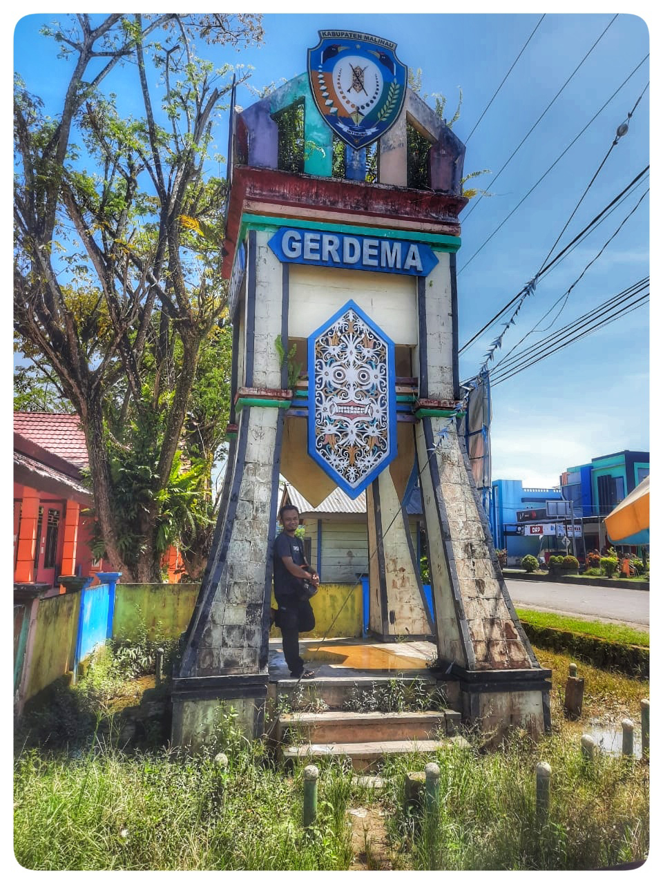
Access to Malinau can be reached by most model of modern car, emmh... A healthy car.  Some peoples were also get there by using a sailing boat from Tarakan harbor.  It's takes about 22 hours and sometimes more from Balikpapan, the distance it self is about 871 km. Experienced driver sometimes will takes no rest during travel.  Don't be surprised if some goods here is more expensive than other places. Malinau has many places for coal mining. Deeply regreted that ex-mining area had made a lot of damages to the environment.  While on the other sides it has increases incomes both for the people and also for the government there. 

Tarakan City

Image
Tarakan- North Kalimantan A place where Malaysian goods and product were mostly used by the people there. A little bit big difference with Indonesian product so they prefer to choose Malaysian goods more than Indonesian.  As noted that Tarakan close to the borderline between Indonesia and Malaysia. 

A routine bridge Inspection Check up

Image
Bridge inspection check up samples.  Sometimes we had also to do a routine check up for bridges along the road that exist.  It has manual inspection procedures.

Central Governmental Services in Bontang City

Image
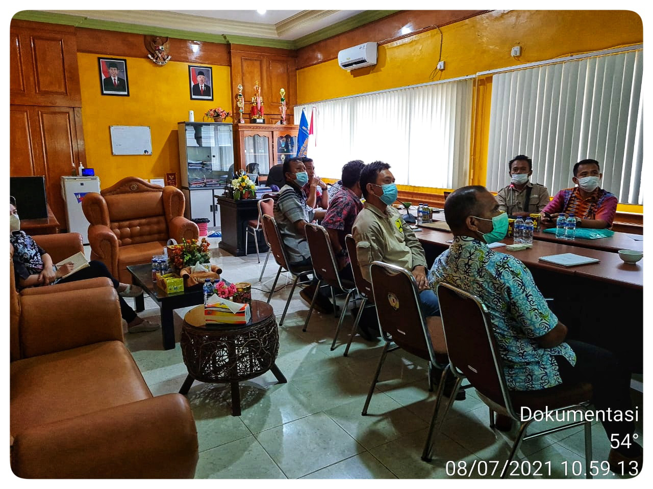
http://dpmptsp.bontangkota.go.id/  Bontang - East Kalimantan This building is a centralized governmental services, a good sample of city management, well at least it was centralized.  A Good model services for the people of East Kalimantan which is should be applied for others places specially in Indonesia.  I was came here to make a deal for the project, a little presentation about road management and survey, to fulfill their demand to do research for road condition in Bontang. 

Northern Part of Indonesia

Image
Malinau which is located in northern part of Indonesia has it's own story for us. In which we have to cook in scratch. Slept anywhere we are during unfinished jobs.  Especially when we must take a long distance trip because it was a long road as procedured must be taken.  In additional condition, a road which has no bridge and we must crossing the river to reach end point of the road.  Special thanks to our supported driver which had a lot of experience. 😊🙏 We miss North Kalimantan. People's and places there were really amazed. 

A taste of coffee

Image
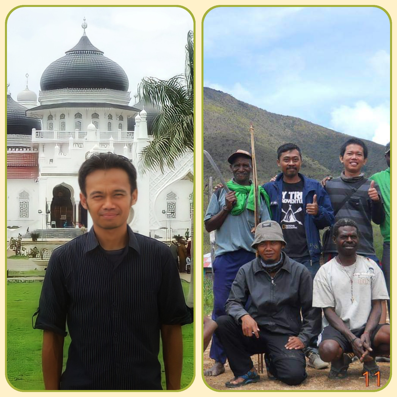
Road survey activities has made me know the western part of Indonesia until the eastern part of it.  Not in detail surely, al least I had known most people were welcomed with many different cultures and beliefs.  I really had to learn more not just their places but also people's who live in. ☺ Years ago at Masjid Agung Aceh (left) and with local people in Manokwari district.  Road condition in Aceh mostly was under good maintenance by government. Maybe that's because it has national status which is under supervision of Central government from Jakarta as central Indonesian government.  A taste of Coffee The people's of Aceh most of them especially male and mature are like to take a cup of coffee both early in the morning or evening. They like to share between them everything at a cafe.  From talking about social activities until political point of views. Coffee in Aceh is famous among them. Deliver best taste to our mouth as a friend when they talk each other's....

Roughometer III Installation (on Avanza)

Image
Installation of Roughometer III ARRB product Survey Location Balikpapan-West Kalimantan

A calibration process (Naasra)

Image
A preparation to calibrate naasra tools to get an exact value of IRI (International Roughness Index). General requirements ; A dipstick profiler.  At least 4 samples conditions of roads were also needed.  There are at least 4 categories road conditions ; Bad Condition, Moderate Condition, Good Condition and Perfect Condition.  Naasra tools with an add on camera to support IRI value result.  A printed manual of calibration procedures for new members team.  Manual calibration process could be found here. 

Installing Front Camera (Naasra)

Image
Setting up front camera to view and capture an images road per setting value, usually it's set up to capture per 100m length of road.  Each road identity from first point until end point of a road must be recorded by using this camera. Usually we take also a second backup camera from GPS Garmin camera which is supported by its GPS add in. We don't want to loose video data if main camera sometime gets error message occurred.  Basecamp setting area Manokwari - West Papua. 

Dipstick Profiler (Sewa dan Penjualan)

Image
Location : Batam  Dipstick profiler Manual user were also available.  To rent or buy this tool please contact below : Hatta Zaujaani +62 81 214 35 9191

Alat Naasra (Jasa Survey dan Penjualan Alat)

Image
In search for road roughness samples in Papua for a local NAASRA tools. SPESIFIKASI ALAT NAASRA (Specifications)  DETAIL PERALATAN NAASRA (Details)  Alat – alat Nasra : Box Sensor GPS ( Model : BU-353) Broadband router :  Model : SMCWBR14T-G,  Input : 9-12 V ( 1 A) Sensor proximity AUTONICS jenis Kaki 4 :  Autonics PR12-4DN Sensor proximity AUTONICS jenis Kaki 3 :  Autonics PR18-8DN USB serial Kabel UTV Box nasra Rantai keteng -(didalam box) Bahan box nasra Allumunium plat Batang pemegang sensor Nepel Kabel kopling Power inverter ( DC 12 V TO AC 220 V 300W) Spesifikasi kamera depan : Power : DC 12 V 600 mA Sensor : 1/3” SONY CCD Interface : 1RJ45 10M/100M UTP CCTV LENS 8mm 1/3 “ IR Spesifikasi kamera belakang : Power : DC 12 V 500 mA Sensor : 1/3” SONY CCD Interface : 1 RJ45 10M/100M UTP CCTV LENS 8mm 1/3 “ IR   2MP Jenis software  Visual Basic 6...